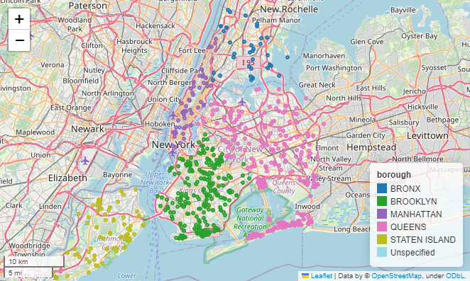
PLUTO & MapPLUTO#
Source 1: NYC Open Data#
Primary Land Use Tax Lot Output (PLUTO)#
Key |
Value |
|---|---|
URL |
https://data.cityofnewyork.us/City-Government/Primary-Land-Use-Tax-Lot-Output-PLUTO-/64uk-42ks |
Description |
Extensive land use and geographic data at the tax lot level in comma–separated values (CSV) file format. The PLUTO files contain more than seventy fields derived from data maintained by city agencies. |
Updated |
2022-08-23 |
Update Frequency |
Every 6 months |
Views |
10.5K |
Data Provided by |
|
Category |
|
API Docs |
https://dev.socrata.com/foundry/data.cityofnewyork.us/64uk-42ks |
API Endpoints |
|
Data Dictionary |
|
README |
MapPLUTO#
Key |
Value |
|---|---|
URL |
|
Description |
Extensive land use and geographic data at the tax lot level in GIS format (ESRI Shapefile). Contains more than seventy fields derived from data maintained by city agencies, merged with tax lot features from the Department of Finance’s Digital Tax Map, clipped to the shoreline. |
Updated |
2022-12-21 |
Update Frequency |
Quarterly |
Views |
6K+ |
Data Provided by |
|
Category |
|
Data Dictionary |
|
README |
Source 2: NYC Dept. of City Planning#
PLUTO#
Key |
Value |
|---|---|
URL |
https://www.nyc.gov/site/planning/data-maps/open-data/dwn-pluto-mappluto.page |
Description |
Extensive land use and geographic data at the tax lot level in comma–separated values (CSV) file format. The PLUTO files contain more than seventy fields derived from data maintained by city agencies. |
Release |
22v3.1 |
Date of Data |
February 2023 |
Data Provided by |
|
Data Dictionary |
|
README |
|
Download |
MapPluto#
Key |
Value |
|---|---|
URL |
https://www.nyc.gov/site/planning/data-maps/open-data/dwn-pluto-mappluto.page |
Description |
MapPLUTO merges PLUTO tax lot data with tax lot features from the Department of Finance’s Digital Tax Map (DTM) and is available as shoreline clipped and water included. It contains extensive land use and geographic data at the tax lot level in ESRI shapefile and File Geodatabase formats. |
Release |
22v3.1 |
Date of Data |
February 2023 |
Data Provided by |
|
Metadata |
|
Download |
MapPLUTO - Shoreline Clipped (FGDB) |
REST API |
In addition to the PLUTO and MapPLUTO datasets, NYC has a rich set of GIS metadata resources. [CityOfNewYork, 2016]
Import Libraries#
External Libraries#
import fiona
Define Variables#
MapPLUTO - Water Included (FGDB)
map_pluto_gdb_folder = 'data/PLUTO/MapPLUTO_22v3_1_water_included.gdb'
Download MapPLUTO Dataset#
Save .gdb data locally to data/PLUTO folder#
!python obtainplutodata.py
Download latest PLUTO and MapPLUTO datasets...

Dataset: "MapPLUTO_22v3_1_shoreline_clipped.shp" already exists.

SUCCESS.

The process has completed.
View MapPLUTO Metadata#
map_pluto_gdb = fiona.open(map_pluto_gdb_folder)
map_pluto_gdb.driver
'OpenFileGDB'
map_pluto_gdb.schema
{'properties': {'Borough': 'str:2',
  'Block': 'int',
  'Lot': 'int',
  'CD': 'int',
  'BCT2020': 'str:7',
  'BCTCB2020': 'str:11',
  'CT2010': 'str:7',
  'CB2010': 'str:5',
  'SchoolDist': 'str:3',
  'Council': 'int',
  'ZipCode': 'int',
  'FireComp': 'str:4',
  'PolicePrct': 'int',
  'HealthCenterDistrict': 'int',
  'HealthArea': 'int',
  'Sanitboro': 'str:2',
  'SanitDistrict': 'str:2',
  'SanitSub': 'str:2',
  'Address': 'str:39',
  'ZoneDist1': 'str:9',
  'ZoneDist2': 'str:9',
  'ZoneDist3': 'str:9',
  'ZoneDist4': 'str:9',
  'Overlay1': 'str:4',
  'Overlay2': 'str:4',
  'SPDist1': 'str:12',
  'SPDist2': 'str:12',
  'SPDist3': 'str:12',
  'LtdHeight': 'str:5',
  'SplitZone': 'str:1',
  'BldgClass': 'str:2',
  'LandUse': 'str:2',
  'Easements': 'int',
  'OwnerType': 'str:1',
  'OwnerName': 'str:85',
  'LotArea': 'int',
  'BldgArea': 'int',
  'ComArea': 'int',
  'ResArea': 'int',
  'OfficeArea': 'int',
  'RetailArea': 'int',
  'GarageArea': 'int',
  'StrgeArea': 'int',
  'FactryArea': 'int',
  'OtherArea': 'int',
  'AreaSource': 'str:1',
  'NumBldgs': 'int',
  'NumFloors': 'float',
  'UnitsRes': 'int',
  'UnitsTotal': 'int',
  'LotFront': 'float',
  'LotDepth': 'float',
  'BldgFront': 'float',
  'BldgDepth': 'float',
  'Ext': 'str:2',
  'ProxCode': 'str:1',
  'IrrLotCode': 'str:1',
  'LotType': 'str:1',
  'BsmtCode': 'str:1',
  'AssessLand': 'float',
  'AssessTot': 'float',
  'ExemptTot': 'float',
  'YearBuilt': 'int',
  'YearAlter1': 'int',
  'YearAlter2': 'int',
  'HistDist': 'str:66',
  'Landmark': 'str:150',
  'BuiltFAR': 'float',
  'ResidFAR': 'float',
  'CommFAR': 'float',
  'FacilFAR': 'float',
  'BoroCode': 'int',
  'BBL': 'float',
  'CondoNo': 'int',
  'Tract2010': 'str:7',
  'XCoord': 'int',
  'YCoord': 'int',
  'ZoneMap': 'str:3',
  'ZMCode': 'str:1',
  'Sanborn': 'str:8',
  'TaxMap': 'str:5',
  'EDesigNum': 'str:5',
  'APPBBL': 'float',
  'APPDate': 'str:10',
  'PLUTOMapID': 'str:1',
  'FIRM07_FLAG': 'str:1',
  'PFIRM15_FLAG': 'str:1',
  'Version': 'str:6',
  'DCPEdited': 'str:3',
  'Latitude': 'float',
  'Longitude': 'float',
  'Notes': 'str:20',
  'Shape_Leng': 'float',
  'Shape_Area': 'float'},
 'geometry': 'MultiPolygon'}
map_pluto_gdb.crs
CRS.from_wkt('PROJCS["NAD_1983_StatePlane_New_York_Long_Island_FIPS_3104_Feet",GEOGCS["GCS_North_American_1983",DATUM["D_North_American_1983",SPHEROID["GRS_1980",6378137,298.257222101]],PRIMEM["Greenwich",0],UNIT["Degree",0.0174532925199433]],PROJECTION["Lambert_Conformal_Conic_2SP"],PARAMETER["latitude_of_origin",40.1666666666667],PARAMETER["central_meridian",-74],PARAMETER["standard_parallel_1",40.6666666666667],PARAMETER["standard_parallel_2",41.0333333333333],PARAMETER["false_easting",984250],PARAMETER["false_northing",0],UNIT["Foot_US",0.304800609601219],AXIS["Easting",EAST],AXIS["Northing",NORTH],AUTHORITY["EPSG","2263"]]')
References#
Fiona#
Fiona | Fiona reads and writes geographic data files | GitHub
conda install -c conda-forge fiona
or
pip install fiona


